Integrating VHR Airbus Pleiades Neo imagery, GPS collar telemetry, and multi-source geospatial data to identify elephant movement drivers and inform corridor design for the Elephant-Human Relations Aid (EHRA) organization.
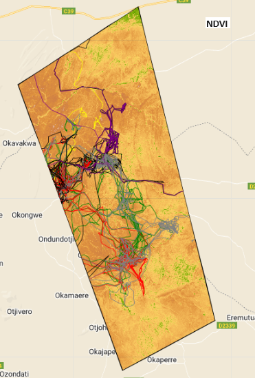
Wildlife Corridor Mapping for Human-Elephant Coexistence in Namibia
wildlife corridor
human-wildlife conflict
Airbus Pleiades Neo
conservation
Satellites for Biodiversity
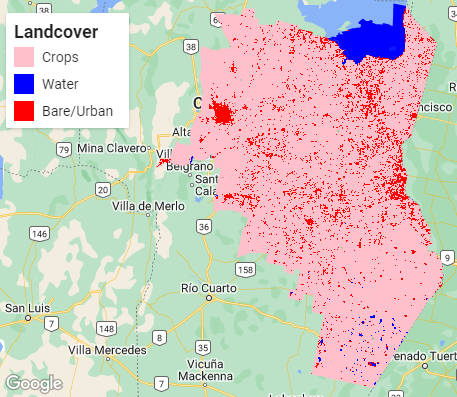
Crop Area Estimation and Yield Prediction Using Remote Sensing and Regression Modelling
Using Sentinel-2 NDVI time-series and regression modelling to estimate planted crop area and predict yield for major crops in Cordoba, Argentina, as a scalable alternative to traditional field-based crop surveys.
crop mapping
food security
NDVI
Sentinel-2
climate-smart agriculture
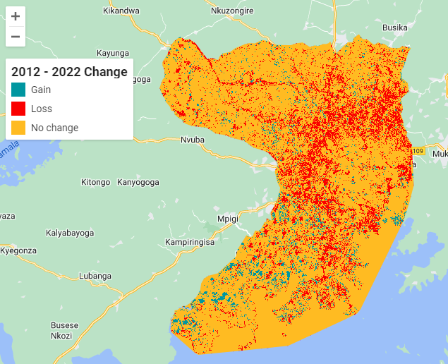
Two-Decade Wetland Loss Analysis in the Lake Victoria Basin Using Landsat Time-Series
Detecting and quantifying wetland degradation across the Lake Victoria basin from 1999 to 2022 using multi-temporal Landsat imagery to inform ecosystem management and restoration policy in Uganda.
wetlands
land cover change
Landsat
Google Earth Engine
ecosystem restoration
Flood Extent Mapping and Damage Assessment in Peru Using Sentinel-2
Assessing the human and agricultural toll of extreme flooding in Piura Province, Peru, using satellite-derived flood extent mapping to support disaster response and climate adaptation planning.
flood mapping
damage assessment
Sentinel-2
Google Earth Engine
humanitarian
Deep Learning for Forest Cover Loss Detection Using Sentinel-2 Imagery
Investigating the potential of deep learning models to detect forest loss from satellite imagery quickly and at scale, supporting forest governance and carbon accounting efforts.
deforestation
deep learning
CNN
Sentinel-2
forest monitoring
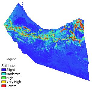
Soil Erosion Risk Assessment Using RUSLE in Google Earth Engine
Estimating annual soil loss in North-Western Somalia using the RUSLE model implemented in Google Earth Engine to support land degradation neutrality and natural resource management.
soil erosion
RUSLE
land degradation
Google Earth Engine
Somalia
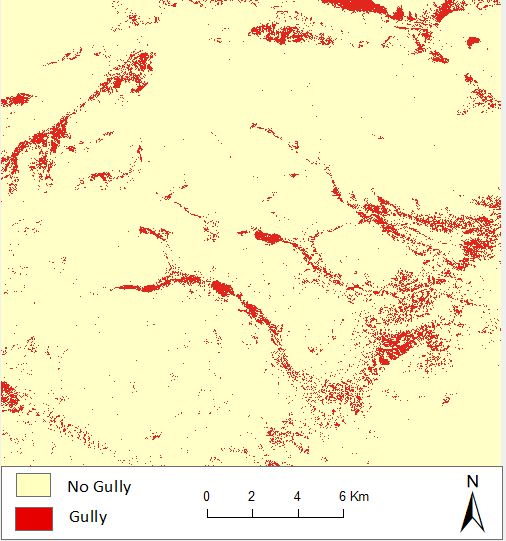
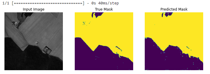
Land Degradation Mapping Using Machine Learning and Sentinel-2 Imagery
Can machine learning reliably identify gully features from satellite imagery to support land restoration and soil conservation programmes?
land degradation
machine learning
Random Forest
Sentinel-2
soil erosion
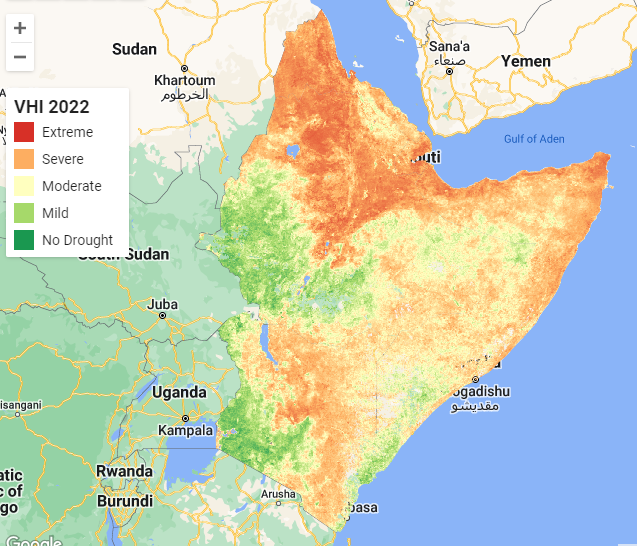
Drought Early Warning in the Horn of Africa Using MODIS Time-Series in Google Earth Engine
Monitoring multi-year drought severity across East Africa using Vegetation Health Index derived from MODIS NDVI and Land Surface Temperature data to support food security early warning.
drought monitoring
food security
MODIS
Google Earth Engine
climate resilience