Exploring Elephant Movement Patterns using Geospatial Data
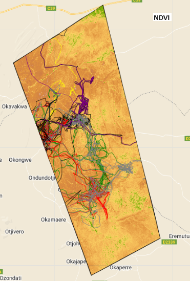
Mapping Potential Elephant Corridor using VHR Satellite Imagery and Telemetry Data
Human-Wildlife conflict
Conservation
Elephant movement
Wildlife corridor
Airbus Pleiades Neo
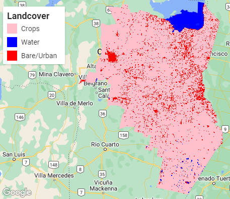
Estimating crop production using remote sensing data
Can remote sensing data be used to estimate crop acreage and yield?
crop production
food security
ndvi
google earth engine
remote sensing
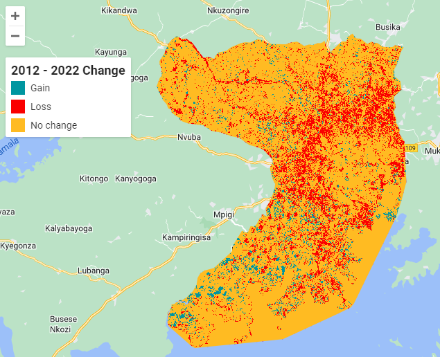
Temporal analysis of Lake Victoria basin wetlands
Detecting changes in wetlands using Landsat time-series satellite imagery
wetlands
landsat
google earth engine
arcgis pro
timeseries
Flood analysis using sentinel 2 data in Google Earth Engine
Flood mapping and damage assessment using mndwi in google earth engine
flood
damage assessment
mndwi
sentinel 2
google earth engine
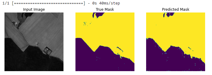
Detecting deforestation using deep learning algorithms
Using deep learning algorithms to detect deforestation in satellite imagery
deforestation
tensorflow
deep learning
keras
sentinel-2
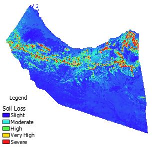
Implementation of RUSLE method in Google Earth Engine to estimate soil loss
Estimating soil loss using RUSLE in Google Earth Engine.
Google Earth Engine
JavaScript
soil loss
land degradation
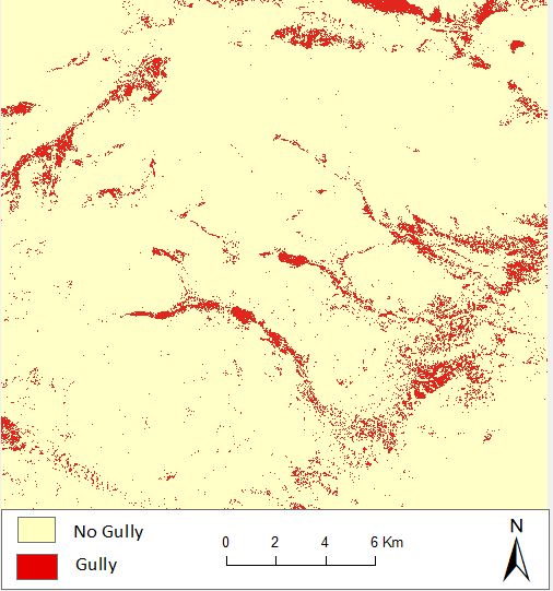
Gully feature identification using Machine Learning
Classification of Sentinel 2 images to identify gullies using Random Forest & Support Vector Machine
Random Forest
Support Vector Machines
Machine Learning
Land degradation
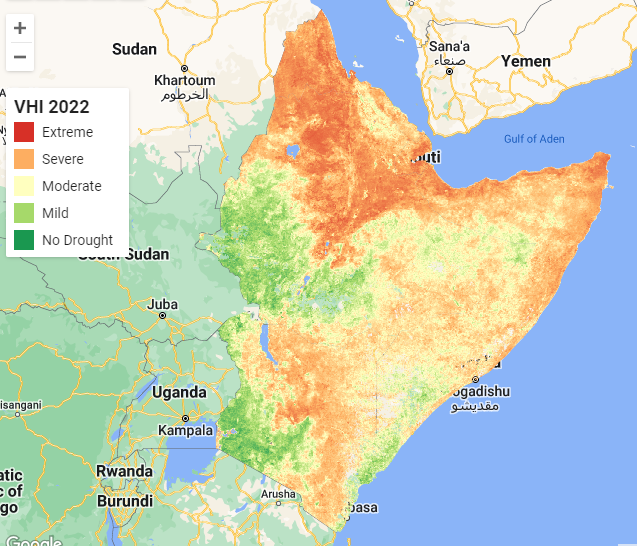
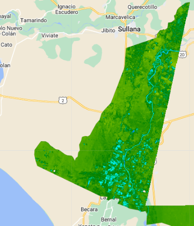
Drought monitoring using Vegetation Health Index in Google Earth Engine
Drought monitoring in Horn of Africa using time-series MODIS NDVI and temperature data in Google Earth Engine
drought monitoring
vegetation health index
temperature
modis
Google Earth Engine